Just recently I scanned through “Bringing Geographical Information Systems into Business” by David Grimshaw (Longman, 1994). The following sentence surprised me:
“Studies have shown that 90% of business data is geographical (Moloney e.a., 1993)”, page 69.
90%? I don’t have access to the Moloney article (my student pass from the library has expired, currently looking for a new one). But most of the time when I hear the statement, I hear “80%”. Honoring the Pareto principle: this is still the case at 80% of the Geo events I attend. Anyone with a good source or is it just a saying?
Personally I don’t use that 80%-statement, but have taken the following approach during recent lectures:
– Please imagine a person, an object, a phenomena.
– Now close your eyes and think of that person, object, phenomena for one minute.
– NOW: think of that person, NOT being in a certain place, NOT being anywhere….!
My point: we cannot even imagine a world where people, objects, phenomena do NOT have a place. Great times for spatial thinking!

Aanstaande donderdag (10 mei) is het zover: het eerste webinar in de Nederlandse Geo wereld. Wat is het? Een webinar is net als een normale bijeenkomst, maar dan “op het internet”: je belt in – beter: je connect – via je computer en je kan zo meeluisteren en -kijken naar wat een spreker te vertellen heeft. Het onderwerp van dit eerste webinar: hoe kan je met ArcGIS Online kaarten en applicaties maken en bewerken, en weer met anderen delen. Maar webinars zijn voor meerdere doeleinden te gebruiken.
Zelf ik heb ik al aan een reeks webinars deelgenomen: soms zijn het auteurs van boeken, die een interview ‘met de hele wereld’ opzetten; soms kan je zomaar aan een college van een universiteit ver weg deelnemen; en soms ben je online met deelnemers van Hawaï tot Hengelo, om te luisteren naar het verhaal achter een mobiele app ontwikkeling op een Android telefoon.
Gaat geominnend Nederland nu aan de webinar? Volgens mij vormen webinars een goede aanvulling op “elkaar echt ontmoeten”. Je kan een webinar (net als tv) vaak terugkijken – of terugspoelen- en actief meedoen is mogelijk door vragen af te vuren. Je doet gewoon vanaf achter je buro mee en inschrijven kan tot kort voor het webinar begint. Een webinar is helemaal van ‘het nieuwe werken’ en ik zie nog wel meerdere webinars om ons af komen. Voor we het weten is de ledenvergadering van GIN (donderdag 31 mei) via een webinar te volgen!
Note: de hoogste tijd om mijn artikel over social media eens te updaten… (naast webinar & tweetups, dan ook aandacht voor Pinterest en Trover).
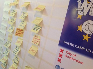 It is a rather silly title of this blogpost, but then again, there was some serious silliness involved at whereCampEU. There wasn’t much official about whereCampEU anyway and the difference with GeoSpatial World Forum certainly could not have been greater (I will get back to that in a column for Directions Magazine).
Expecting the unexpected
I hope the program delivered some of the “expect the unexpected” promise we made. Unexpected to me were Tim Waters (who’s presentation I missed, but it found its way to slideshare ‘s frontpage!), Laurence Penny (@lorp) on one-dimensional maps (showed Google’s StreetView from over a century ago) and Roman routing by René Voorburg of http://omnesviae.org/ (wish we had a omnesmarae as well!).